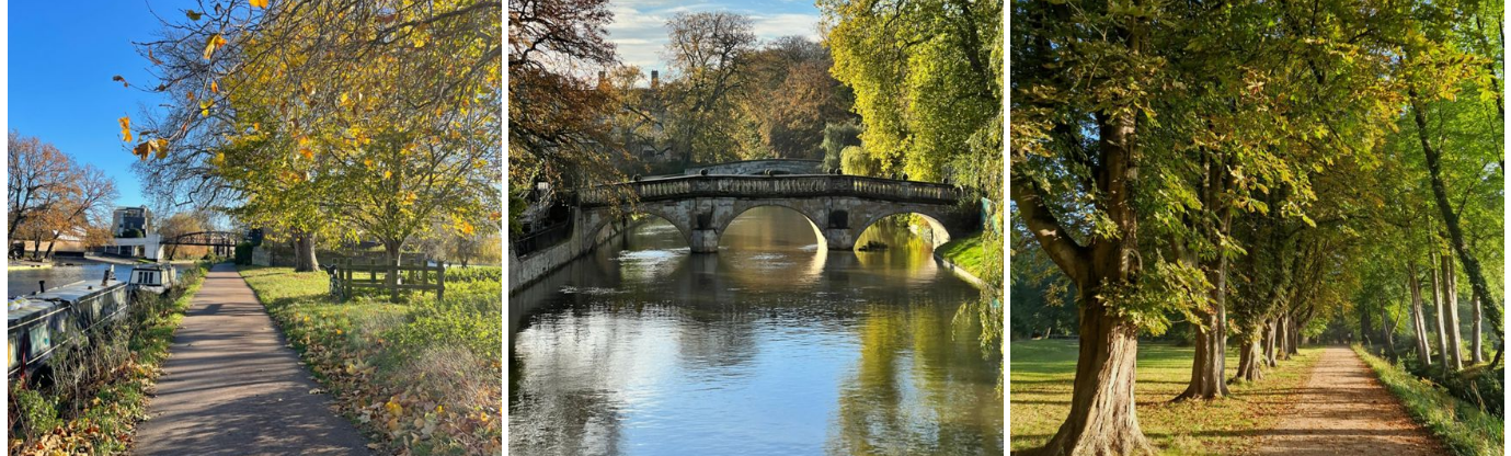
Cambridge is one of the most beautiful places in the country for walking. As well as stunning architecture, and well trodden paths like the Backs, there are lots of hidden gems.
Discover more of the passageways and green spaces on the doorstep, with our library of routes below. The routes range from a twenty minute, one mile stroll, to longer routes taking in more of the city and beyond. If you log your walking or running on Strava, join our community by searching for 'University of Cambridge'.
Did you know?
Just 30 minutes of moderate physical activity per day, like brisk walking, is enough to have a huge impact on your physical health - as well as your brain performance!
- If you're looking to build a walking habit, try downloading the 'Active 10' app from the NHS? This brilliant app encourages going for a 10 minute brisk walk every day, with a helpful pace checker, tips to boost your activity, and you can add it as a widget to your phone home screen to stay on track.
Picking up the pace
The routes below are also all suitable for running.
- The NHS also offers the brilliant 'Couch to 5K' app, to help you move from walking to running steadily, and is used by millions every year.
- If you need advice on warming up and getting the right muscles activated for running, we have a short instructional video to help you. But if in doubt, a brisk 10 minute walk to start goes a long way!

How to access
- Select the walks and you can follow the route through your phone with GPS!
- The route maps below are all available to download as a GPX file - we recommend using the Ordnance Survey Maps App to view the files!
- Routes 1, 5, 6, 7 and 9 are wheelchair accessible, while there are potentially challenging muddy and/or grassy sections on the other routes.
- Want to learn more about walking groups at Cambridge, 'Cambridge Walks'? Contact us on activestudents@sport.cam.ac.uk
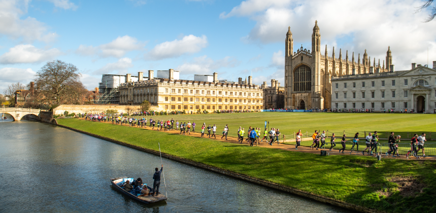
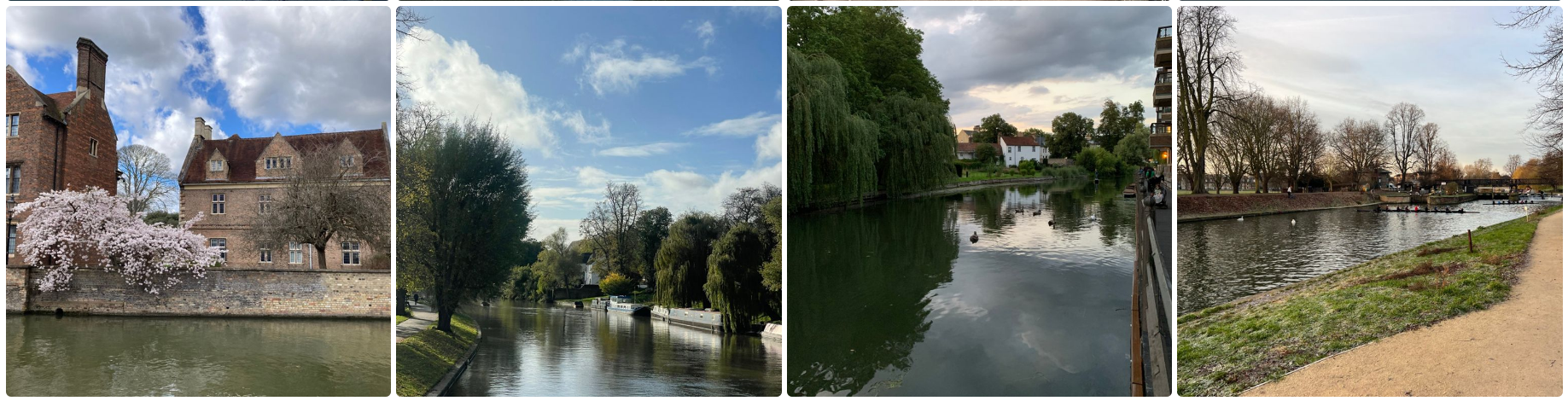
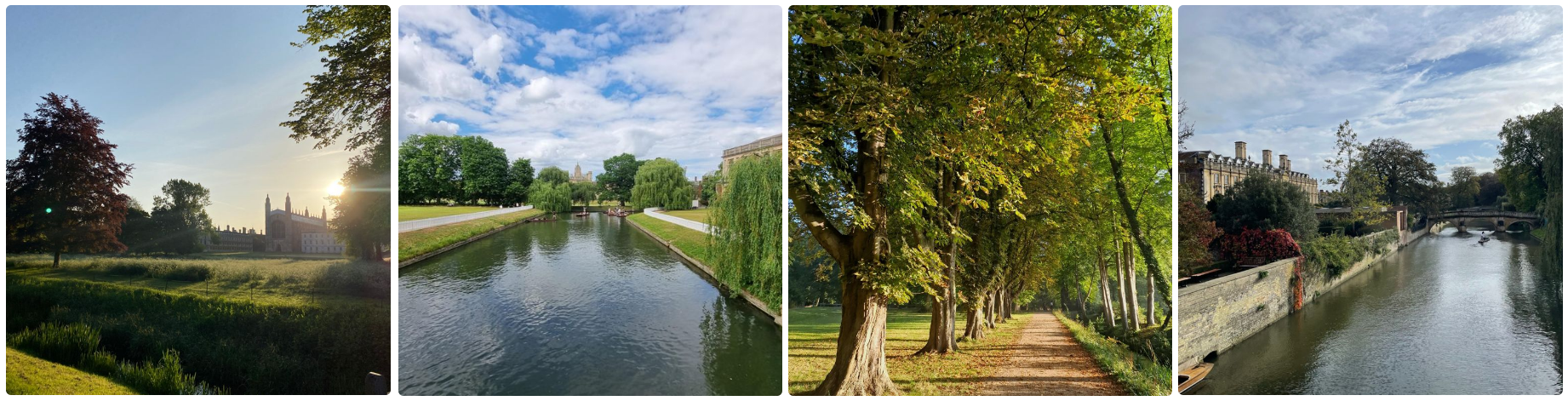
This circular city walk takes you around the highlights of Cambridge, visiting The Backs, a picturesque area where several colleges of the University of Cambridge back on to the River Cam. It's a delightful area for a stroll with magnificent architecture including St John's College, King's College and the bridges over the River Cam.
Starting at Parkers Piece, the walk first passes Downing College. Founded in 1800, it was the only college to be added to Cambridge University between 1596 and 1869, and is often described as the oldest of the new colleges and the newest of the old. Continue past Peterhouse College to the Mathematical Bridge over the River Cam. The Grade II listed wooden bridge was originally built in the 18th century and connects two parts of Queens' College. The route then passes around Queens' College, spanning both sides of the river and with some of the most recognisable buildings in Cambridge.
The trail then heads around the back of King's College, St John's, Trinity, and Trinity Hall. The route crosses the Cam via Garret Hostel Lane, then through Trinity Lane and Bridge Street before coming to Magdalene College.
The route along the river always has Magdalene in sight on the other side. The route crosses Jesus Green over to Jesus Green Lido - a great spot for a swim, but not for the fainthearted outside of summer! - under the bridge over the Cam via the pedestrian footpath, and then heading south towards Jesus College across Midsummer Common.
After passing through the park, you head around Jesus College on the right. The final section takes you through Christ's Pieces and Parker's Piece. Parker's Piece is regarded as the birthplace of the football, including a fascinating sculpture depicting the original Cambridge Rules of Football.
Route 1: The Colleges Loop (5km / 1 hour): Click for Route Map!
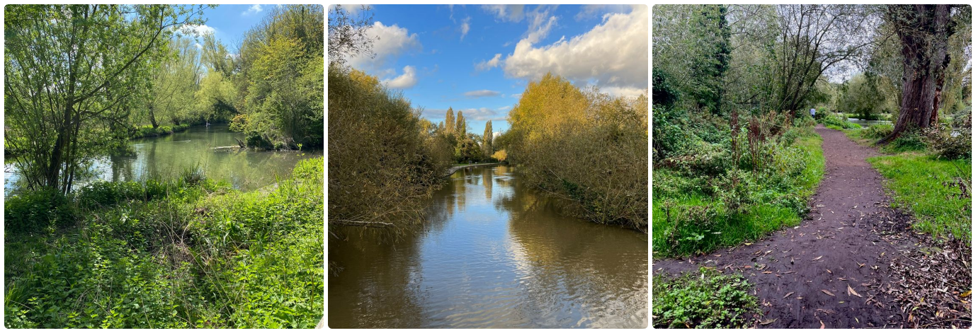
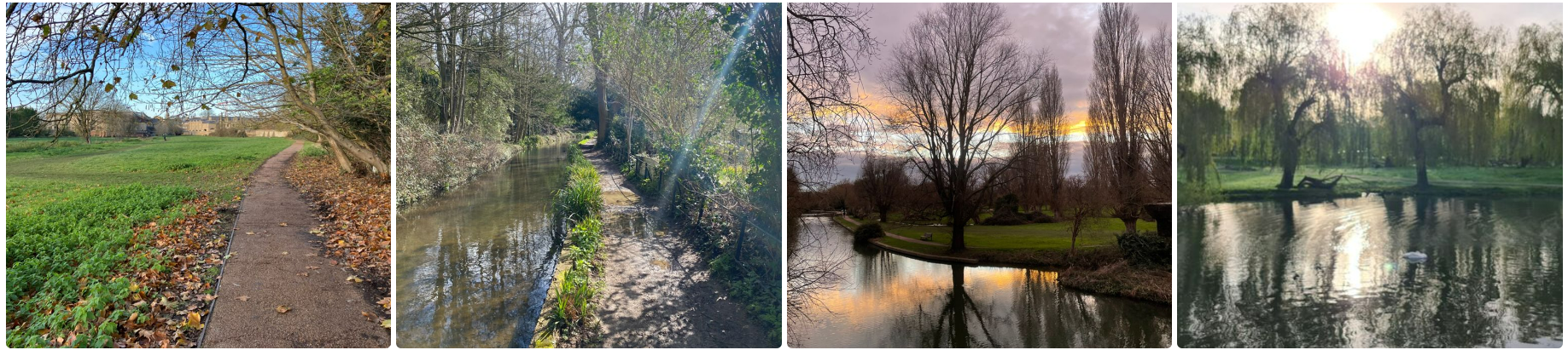
This short, out and back route is a real hidden gem. Starting from the Bowling Green at Lammas Land, head south via the path to the left of the car park along the trail.
This route can be muddy, as it follows the river, and you're certain to be able to connect with nature amongst the tranquil trees and wildlife at the reserve. Paradise Nature Reserve is a preserved marsh and wooded area on the bank of the river. Take your time, and keep an eye out for the kingfishers!
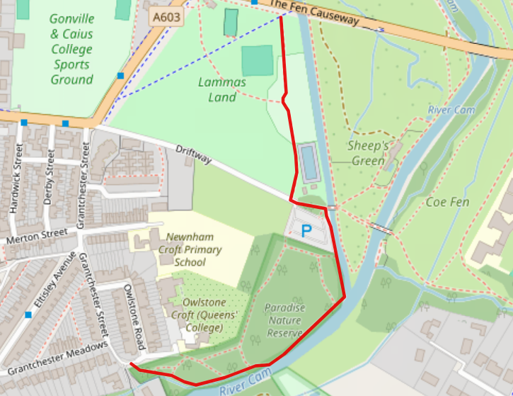
Route 2: Lammas Land and Paradise Nature Reserve (1.6km / 20 minutes): Click for Route Map!
Starting from the University of Cambridge Sports Centre, this route heads over the M11 footpath to the Coton Countryside Reserve, a beautifully kept local spot, which even includes a hill (a novelty in Cambridge!) - but not on this exact route.
The walk starts by heading west from the Sports Centre, around the little known lake at West Cambridge, then over the M11 footbridge.
The Countryside Reserve has miles of paths among 300 acres of a preserved wildlife area, and the circular route takes in just a few of the paths around the reserve, first heading south before circling back north. The route returns to West Cambridge via the Coton Recreation Ground and The Coton Footpath - which you can follow all the way from Coton into the centre of Cambridge.
Route 3: West Cambridge and Coton Countryside Reserve (5km / 1 hour): Click for Route Map!
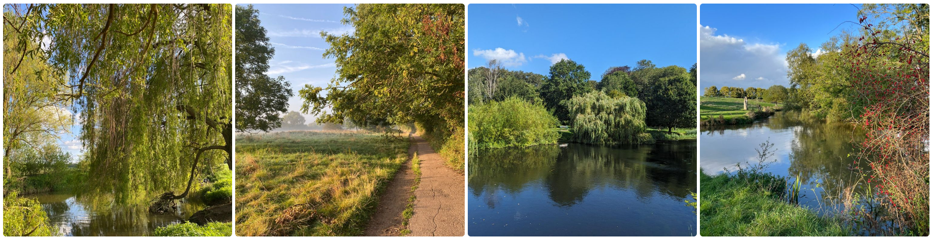
This well known, scenic route starts at Lammas Land, opposite Gonville and Caius Sports Ground, but you could start the route further along at St. Catharine's College Sports Ground, opposite Skater's Meadow - this is the first milestone on the route. Decades ago, the meadow used to freeze over every year, allowing the Cambridge community to ice skate in the winter.
As you arrive at Grantchester Meadows, the route passes through fields - mind out for cows! - along the cycle path, before arriving in the village of Grantchester, well known for the BBC drama. There are several excellent cafe's and pubs in the village to stop to refuel before the return journey, which follows the river all the way along the bank back to Skater's Meadow.
The Meadows is a very popular spot in the summer for picnics, but it's a great place to visit all year round with views across the lazy River Cam.
Route 4: Grantchester Meadows (5.5km / 1 hour 10 minutes): Click for Route Map!
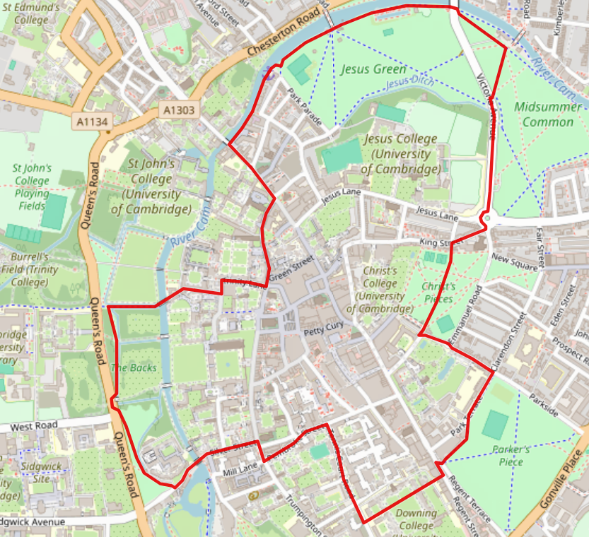
This route is a circular one taking in some of the best parks in Cambridge. Starting at the south west corner of Jesus Green, next to Jesus College, first head north along Park Parade towards the river. The route passes the Maypole pub on the left and tennis courts on the right as it joins the river path.
Follow this path past the Jesus Green Lido and underneath the bridge, where you'll arrive at Midsummer Common. On the other side of the river as you walk along, you'll see the many college boat houses, as well as the Cambridge University Boat Club boathouse, known as Goldie. As you turn to complete the loop, you'll pass through Midsummer Common, which holds a number of large events each year, and also hosts the famous Cambridge urban cows!
Take care as you cross the road back over to Jesus Green to complete the full loop.
Route 5: Jesus Green and Midsummer Common (2.6km / 35 minutes): Click for Route Map!
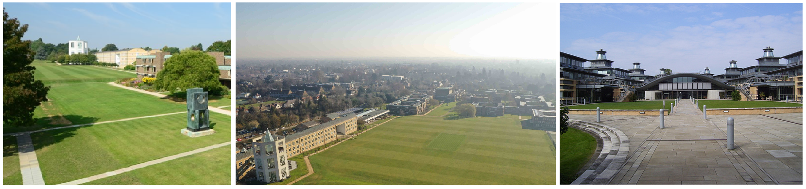
Starting from the Department of Mathematical Sciences, this route takes a loop of the beautiful grounds of Churchill College just over Madingley Road. Head north on the footpath next to Maths, crossing at the traffic lights, and use the entrance along the road heading west next to the tennis courts.
There is a marked path all the way around the ground, passing the main Churchill College buildings, plus the sports grounds, outdoor gym, and chapel on the loop before heading back to Maths! A great option for a lunchtime stroll or a walking meeting.
Route 6: Churchill College Grounds (2km / 25 minutes): Click for Route Map!
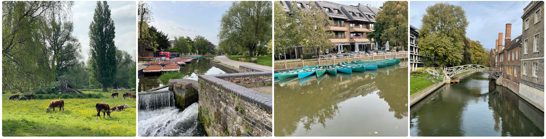
Starting outside the Mill Pub and the University Centre, home of Cambridge SU, this route finds wild, natural places right next to the city.
Heading south, the route crosses Sheep's Green and Lammas Land before looping around, passing the Crofters Cafe, and following the River Cam back to the Mill Pub. This short route is always a great one for taking your binoculars to see birds along the river, and to watch amateur punters try (and occasionally fail) to stay out of the water!
Route 7: Sheep's Green and Lammas Land (2km / 25 minutes): Click for Route Map!
Starting in the same location as Route 7, this route is slightly longer and also takes in the peaceful Coe Fen, which runs along the back of Peterhouse College and the Fitzwilliam Museum.
As you progress through Sheep's Green and Lammas Land, you'll head straight into Coe Fen via the bridge over the River Cam, from where you can look south towards Paradise Nature Reserve and Grantchester. As you reach Trumpington Road and begin your return, on the other side of the road you can see the Cambridge University Botanic Gardens, a stunning place to visit year-round, with many events - and free entry for Cambridge students!
Returning through Coe Fen, look out for the local wildlife, including Kingfishers, Herons, and many kinds of small birds - as well as the Cambridge urban cows!
Route 8: Sheep's Green, Lammas Land and Coe Fen (3km / 40 minutes): Click for Route Map!
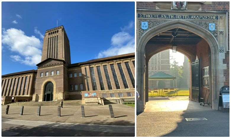
This route circles Sidgwick site, the University Library and Newnham College. Starting at Sidgwick, head north past the Law Faculty building in the direction of the library. A handy guide on this walk is that you can almost always use the library as a reference point, as it stands so high above other buildings.
After passing the library, turn left onto the Burrell's Walk path, and then left onto Grange Road. You'll immediately pass the Cambridge University Real Tennis Centre on your left, with Robinson College on the right.
Further along, you'll see the Cambridge University Rugby Union Football Club on your right with its historic turnstiles, and Selwyn College on your left - whose grounds are well worth exploring!
Heading south along Grange Road, just after you pass Selwyn College is the lane taking you to Corpus Christi Sports Ground (Leckhampton) on the right. If you want to cut the walk short at this point, head left along Sidgwick Avenue back to the start point.
Continue along Grange Road, then take a left on Champneys Walk, where the road is quiet and curves around to join Barton Road. Head east along Barton Road for 100m, then head left towards Newnham College just before the turning for Clare Road.
The walk through Newnham College grounds is very beautiful, past the sports ground and garden, and out onto Newnham Walk, which you'll follow around to complete the loop at Sidgwick!
Route 9: University Library, Newnham & Sidgwick (2.8km / 40 minutes): Click for Route Map!
This walk starts at the rear entrance for King's College on the Backs. Head north along the Backs, passing King's and Trinity Colleges on the right. As you reach St. John's College, cross the road, and take the path through St. John's College Sports Ground.
After you reach the next gate, cross over and head west along Clarkson Road, passing the Department of Mathematical Sciences on the right. At the end, head south along Wilberforce Road, passing Emmanuel College Sports Ground on the right. At this point, you can either head along Adams Road to cut the route short, or continue the suggested route.
Enter Wilberforce Road Sports Ground and take the pedestrian entrance, and then immediately turn right to join the perimeter track loop. This loop takes in a peaceful spot with a lake and wildlife - look out for herons and muntjac deer! Following the loop around, you can see the hockey pitches, athletics track and pavilion, before arriving at the car park and then onto Adams Road.
Heading east along Adams Road, passing Robinson College on the right, cross straight over onto Burrell's Walk. Continue along this footpath, passing the University Library on the right. As you reach Queens' Road, head back to the starting point outside King's.
Route 10: The Backs', St. John's College Sports Ground & Wilberforce Road Sports Ground (4.3km / 50 minutes): Click for Route Map!
This route takes you out of Cambridge, starting from the car park at the Gog Magog Hills. This route provides stunning views over Cambridge, and on a clear day you can see all the way to Ely from Wandlebury Country Park.
Route 11: Wandlebury Country Park and the Gog Magog Hills (6km / 1 hour 20 minutes): Click for Route Map!
Find more Cambridge sculpture tours via Cambridge Sculpture Trails.
This route starts in the main square at Eddington, next to the Post Doc Centre and Swirles Court.
Heading east, the route crosses the road and into the preserved land and fields towards peaceful footpaths, before a short stretch along Huntingdon Road and then back into Eddington. The route then passes the magnificent 'Veteran Oak' tree, before heading on towards the Brook Leys Nature Reserve. Look out for the sculpture installations, and wildlife on the water, including cormorants, swans and herons.
Heading back to Eddington, finish at the main square opposite Sainsburys and several cafes.
Route 13: Eddington and Brook Leys (3.5km / 40 minutes): Click for Route Map!